expr:class='"loading" + data:blog.mobileClass'>

Friday, May 27, 2016

EF4 tornado


EF4 tornado leaves trail of damage across Kansas on Wednesday.


A powerful, wedge tornado moved across north-central Kansas Wednesday evening, leaving a trail of damage in its wake.
"The tornado developed around 6 p.m. CDT near Minneapolis, Kansas," AccuWeather Storm Warning Meteorologist Amber McGinnis said.
The tornado tracked near the towns of Solomon, Abilene and Chapman. It remained just to the north of Interstate 70 much of the time before crossing the road near Chapman.

EF4 tornado located a few miles northeast of Solomon, Kansas,
A large, wedge tornado located a few miles northeast of Solomon, Kansas, Wednesday evening. (Photo/@THUNDR1)


"It lifted southeast of Chapman, Kansas, around 8:30 p.m. CDT," McGinnis said.
A damage survey from the National Weather Service in Topeka, Kansas, rated the tornado as an EF4 with estimated peak winds of 180 mph.
The tornado damaged numerous buildings along its path and also overturned cars.
A press release from the Kansas Highway Patrol estimated between 15 and 25 homes were either substantially damaged or destroyed.
At some points during its track, the tornado was estimated to be half a mile wide.
The same storm produced another large tornado to the west of Harveyville, Kansas, around 10:30 p.m. CDT.
No fatalities or injuries were reported from the storm.
Video....

Damage to a home on the southwest side of Chapman, Kansas. The vehicles were where the garage and barn used to be.EF4 tornado
Damage to a home on the southwest side of Chapman, Kansas. The vehicles were where the garage and barn used to be. (Photo/@hilde31)

Building damage and trees debarked on the southwest side of Chapman, Kansas. A camper was also in the barn but no where to be seen. EF4 tornado.
Building damage and trees debarked on the southwest side of Chapman, Kansas. A camper was also in the barn but no where to be seen. (Photo/@hilde31)

House Destroyed just SW of Chapman.Woman in the house survived here in the basement.

Tornado crossing over Interstate 70 near Chapman, Kansas, on Wednesday evening. (Photo/@JCLafa)
EF4 Tornado
Tornado on the ground across north-central Kansas on Wednesday evening. (Facebook photo/Jake Mulholland with credit to Sarah Symborski)
#KS Highway Petrol

source: www.accuweather.com

Saturday, May 21, 2016

Thousands of oil workers evacuated as Alberta wildfire spreads


Thousands of oil workers evacuated as Alberta wildfire spreads.

Alberta wildfire

                         Alberta wildfire


Up to 8,000 oil workers were evacuated from camps north of Fort McMurray, Alberta, Monday after the wildfire that destroyed large parts of the city earlier this month expanded rapidly.
The fire has grown in size significantly this week, rising to 505,000 hectares on Thursday and crossing the Saskatchewan boundary. The Blacksand Executive Lodge, capable of housing 655 workers, was destroyed by fire Tuesday.
Many of the workers were being evacuated for a second time in less than two weeks, having only arrived back in the area days before as the oil companies sought to quickly restart production following the evacuation of 90,000 Fort McMurray residents.
Alberta Premier Rachel Notley unveiled a “conditional timeline” for residents to return to the city Wednesday, saying that this process would begin June 1. The first step will see residents returning on a voluntary basis, before all residents join them June 15. She said that this was dependent upon the fire no longer threatening the city, the hospital being open and able to provide basic health services, 911 service being available and fire and police services operational, all roads being open to traffic and utilities restored, and supplies of potable water and food being provided.
Notley added that schools would not reopen until September. A total of 2,432 buildings were destroyed in the city, and over 500 were severely damaged. A further 10 homes were damaged in an explosion Monday night.
No serious damage has been reported to the region’s tar sands facilities, which are surrounded by large firebreaks and equipped with teams of industrial firefighters.
The catastrophe provoked by the wildfire is a product of the capitalist system’s ruthless pursuit of profit at all costs. Multibillion-dollar windfalls have been obtained by the major oil corporations through the vast expansion of the tar sands operations over recent decades.
Fort McMurray, which exploded from a small town with a population of just 35,000 in 1990 to over 100,000 at the peak of the oil boom in 2014, exemplifies the way in which basic social services and infrastructure were sacrificed to cut costs. While every conceivable measure has been taken to protect the tar sands production facilities, the ruling elite saw the workers as disposable assets. The lack of preparedness for wildfires was exacerbated by the impact of climate change and a strong El Niño effect.
Even as workers were rushed back into the region to restart production, reports indicated how unsafe the Fort McMurray area remains. On Monday morning, the provincial government reported air contamination rates were off the charts, reaching a reading of 38 on a scale that normally runs 1 to 10. It rose even higher, to 51, on Wednesday morning. This prompted an order for all firefighters and other emergency workers in Fort McMurray to wear gas masks, while Alberta Health Services ordered other workers planning to return to the area to help with recovery work not to do so. There are several hundred workers in the city attempting to prepare the hospital for reopening at the end of the month, and others reconnecting electricity and gas supplies.
Scientists are also warning that local water supplies will be contaminated with hazardous materials, and that rain will make the problem worse by washing ash and other debris into the Athabasca River, from where Fort McMurray obtains its water supply.
Many of the oil workers compelled to be frantically evacuated as the fire closed in this week explained they had no option but to return to work, even if conditions were unsafe. Lucy Fitzgerald, a Suncor employee, who like many moved from Canada’s east coast to work in the tar sands, told CBC, “It’s a day-by-day thing right now, and that’s all I can do. It’s either that or go home, and stay home, and I can’t afford to do that right now.”
Others spoke out anonymously about their frustration at the oil corporation’s pursuit of profit, which had seen workers sent into an active emergency zone. “Yeah, without a doubt. They lose so much money a day that that’s all they see,” a contractor told the Globe and Mail .
Prime Minister Justin Trudeau rejected from the outset any attempt to provide a “political” explanation for the disaster, sharply criticizing the suggestion by Green Party leader Elizabeth May that climate change may have played a role.
This has won him plaudits in ruling circles, who see the crisis as an ideal opportunity to build public support for pipelines to enable the large corporations to transport oil from Alberta’s tar sands to tidal water. CBC enthused over the “positive media buzz” surrounding Trudeau’s May 13 visit to Fort McMurray and Edmonton, and pollster Bruce Cameron commented that it was refreshing to see discussion about the oil sands that did not concentrate on environmental problems or climate change, but the “human face.” Far from being concerned with the lives of ordinary residents, he laid out what for him was significant about this, stating, “It could have longer term implications in terms of making a human face for the oil sands.”
More information continues to come to light about the utter lack of preparedness at all levels of government, despite repeated warnings about the wildfire risk.
Over 70 percent of the Alberta government’s FireSmart budget, which is supposed to be dispersed to local communities to support fire mitigation measures, has remained unspent since 2014. Of the total funding of $23.6 million received by the Forest Resource Improvement Association of Alberta between 2014 and 2016, only $6.9 million had been allocated. This translates into 71 cents of every dollar remaining unspent.
Even more troubling was the rejection rate for communities who applied for funding. Of the 223 applications sent in by 80 communities from across the province in the past three years, only 113 were approved. Most of those declined because projects were deemed “ineligible.” However, the provincial government continues to insist that local communities must take the lead in wildfire preparedness.
This comes on top of the cuts to provincial wildfire budgets, including the New Democatic Party (NDP) government’s slashing of the contracts for air tankers used to fight fires just three weeks prior to the Fort McMurray evacuation. The move means that as of August 16, Alberta will have no air tanker coverage in place, even though the fire season runs well into October.
At the federal level, persistent warnings have also been ignored. Jim Carr, the Liberals’ natural resources minister, received an explicit warning about the growing wildfire risk in briefing notes last year when he entered office. A 2005 wildfire strategy agreed by the federal and provincial governments is effectively stalled due to lack of funds.
Compared with the vast wealth extracted from the tar sands, the resources made available by the authorities to support the evacuees have been paltry. The Alberta government has paid $1,250 to every adult and $500 to each dependent, while the Red Cross, thanks to over $65 million in donations from across the country, paid out $600 per adult and $300 per dependent.
The Edmonton Emergency Relief Services Society, which is running the main evacuation camp at Northlands, has stated there is a “desperate” need for donations to keep up with demand.
The critical task of distributing the basic necessities of life to thousands of families trying to get by with little financial resources has fallen to volunteers. The society issued a call Tuesday for more to come forward. More than 4,000 have assisted at a makeshift distribution centre set up at an Edmonton mall. “We would never be able to [do] it without the volunteers, they are our legwork and heart of what is going on,” a coordinator told the Edmonton Journal. “We do have to stress enough that we still cannot continue to be able to maintain and help as many evacuees without their ongoing support.”
The cramped conditions in the camps have contributed to the rapid spread of stomach sickness. On Monday, it was reported that 281 evacuees had contracted a gastrointestinal illness, an increase of 138 percent in six days. “It’s very hard to keep it from spreading,” said Joanna Oda, a medical officer with Alberta Health Services. “This is not unexpected. This is what happens when many people are gathered in smaller places.”


source: www.wsws.org

Disasters kill 158 in four months


Disasters kill 158 in four months.

Houses destroyed in May due to Twante canal bank erosion (Photo-EMG


The natural disasters and man-made accidents from January to April this year have killed 158 people and destroyed more than 8,700 homes nationwide, according to the Myanmar Fire Services Department.

Landslides, riverbank erosions and strong winds contributed to 398 disasters and accidents during the months.

Strong winds destroyed two schools, an office, a library, three monasteries and 71 houses in April in Kyangin Township, Ayeyawady Region, in the most recent incident recorded.

The country has now 17 search-and-rescue teams with 333 small squads and a workforce of more than 13,000 for rapid response to disasters.


source:www.elevenmyanmar.com

Predictions of change alongside the aftermath of the recent extreme weather


Predictions of change alongside the aftermath of the recent extreme weather.

weather map.
Director General of the Department of Meteorology Lalith Chandrapala commented on the weather 


Director General of the Department of Meteorology,Lalith Chandrapala pointed out that the weather condition of the country is now getting back to normal and also during the past 12 to 18 hours, the country, specially the Kelaniya area has not experienced heavy rainfall.
He further added that rainfall can be expected in the north west, Sabaragamuwa, Central and Western provinces due to the impact of the cyclones and the cyclone named Raonu has traveled 1600 km north east from Kankasanthurai and is expected to move to Bangladesh through Chittagong tonight or in the early hours of tomorrow and after it enters into Bangladesh the strength of the cyclone will reduce and then, the impact it has towards Sri Lanka will reduce.
The Department of Irrigation today announced that the severe flood situation is reducing following the reduction of the water levels of the Kelani River.
Catchment areas of many rivers experienced fair weather during the past 24 hours. The Department of Irrigation noted that due this the floods in many areas have reduced.
Water levels of the Kelani river is also reducing gradually. Despite flood waters, there are many who continue to remain in their inundated houses in areas on either side of the Kelani River because of the fear of their belongings being looted and the lack of means to travel to safer ground.
The Sri Lanka Army and the Sri Lanka Navy continue to engage in search operation and missions to provide food relief.
Though people managed to move to safer locations when flood waters hit, caged animals in these areas had to face the brunt of the rising waters. Such a group of animals were released today in this manner.
Areas such as Kaduwela, Hangwella, and Biyagama are still affected by the floods. Kaduwela entry point of the Kadawatha Matara expressway continues to be closed.
SSP Ajith Rohana who is charge of Colombo – North commented on providing security to public property owing to floods.
Another landslide was reported in Aranayake this afternoon when part of the Ambalakanda gaveway. District Secretary of Kegalle, Abeywickreme Wanasooriya said that relief teams were dispatched to the area. This is the third landslide reported in and around the Aranayake area.
The first landslide was experienced in the Siripura area where a large number of people were reported missing. Saama-sara hill experienced a landslide yesterday.

Today’s landslide was reported in the hill which is situated opposite to the Siripura hill and operations in search of those who went missing in the landslide continue

Major General Sudantha Ranasinghe who is in charge of the search operation reported that a body and several limbs were recovered during the search. Prime Minister Ranil wickremesinghe visited the Aranayake area today.

A Presidential task force was established to manage the damages caused by Natural Disasters that occured due to the prevelent inclement weather conditions under the directions of Preisdent Maithripala Sirisena.
Several countries have already come forward to assist Sri Lanka at this time of need.
The first batch of relief material was received from India. Two Naval ships that were sent from Kochi harbour in India consisted of 25 tonnes of goods. The goods include, food items, water, clothes and medicine.
ndian high commissioner to Sri lanka Y.K. Sinha and deputy minister of foreign affairs, Dr. Harsha de Silva were present at the occasion where these goods were handed over to Sri lanka.

Meanwhile India has also sent goods weighing 50 tonnes by air today. A stock of aid from the Japanese government too reached the island yesterday, while Australia has come forward to provide 500,000 dollars to the Sri lanka government in aid.

The ministry of disaster management has announced that 73 deaths were reported during the past few days due to various disaster situations. 127 persons are still missing following the disasters that were reported this week.

Disaster management center said that affected people are temporarily housed at 497 welfare centers while over 93,000 families are still being affected by the weather.
Around 5000 residents living around the Meethotamulla Garbage dump are victimized by different pandemics that are spreading.

What can be witnessed in the other areas that were inundated is mud. However areas surrounding the Meethotamulla garbage dump is submerged in black garbage water. This garbage water has been flowing in this area for the past four days. The Meethotamulla area which was famous for its infamous garbage dump, now has a river of garbage water flowing across it.


sourec: www.newsfirst.lk

Saturday, April 23, 2016

WORST NATURAL DISASTERS

NATURAL DISASTERS


The world has witnessed numerous disasters over the centuries and although most are man-made due to wars and terrorism, mother nature certainly dishes out her fair share of damage. While there are many criteria as to what would be considered the “worst” natural disaster ranging from lives lost to cost incurred, the earthquakes, typhoons, and tsunamis you are about to witness are all horrific in their own right.  Here are the some worst natural disasters ever recorded.


Haiti Earthquake (2010)


A magnitude 7.0 earthquake that has a depth of 8.1 miles rocked Haiti on January 12, 2010. Its epicenter was located just south west of Port-Au-Prince with 59 aftershocks ranging from 4.2 to 5.9 magnitudes in strength. The strongest earthquake to hit the country since 1770, it had led to over 200,000 deaths, 2 million homeless, and 3 million people in need of emergency aid. At least US $195 million have been given with another US $120 million pledges from different countries, along with a large number of aid workers to help with rescue operations.

Cyclone Nargis (2008)


The first cyclone in 2008 to hit the northern Indian Ocean, Cyclone Nargis made landfall in Myanmar and devastated the Ayeyarwady Delta region along with its 37 townships for two days. Official figures showed that 84,500 people were killed with 53,800 missing. An equivalent of a category 3 or 4 hurricane on the Saffir-Simpson scale, it led to numerous storm surges and flooding.

Pakistan Earthquake (2005)

The 2005 Pakistan earthquake, that registered 7.6 in the Richter scale, had its epicenter in Kashmir near the city of Muzaffarabad. It occurred on the morning of October 8, 2005 and the official death toll was 75,000 people with 106,000 people injured. The severity of the damage was attributed to the poor construction of the buildings. Over US $5.4 billion in aid arrived from all over the world to help with rescue and relief efforts.

Hurricane Katrina (2005)

The deadliest hurricane to hit the Gulf Coast in 2005, it was ranked as the sixth strongest overall to hit the United States. It was also one of the costliest with estimated property damages of US $81 billion.

Indian Ocean Earthquake (2004)

Also known as the Sumatra-Andaman earthquake, it was estimated to be a magnitude 9.15, and occurred on December 26, 2004. While the earthquake itself lasted for only 10 seconds, it caused a tsunami that killed 200,000 to 310,000 people along the shores of Indonesia, Sri Lanka, South India, and Thailand with one death even occurring at Port Elizabeth in South Africa, 8,000 miles away from the epicenter.

Nevado del Ruiz Volcano Eruption (1985)

Also famed as La Mesa de Herveo, this stratovolcano holds the distinction of causing the second largest volcano-related disaster of the 20th century. The volcano, which generally generates Plinian eruptions or swift-moving currents of hot gas and rock called pyroclastic flows, produced an enormous flow that buried and devastated the town of Armero in Tolima in November 13, 1985. What was tragically known as the “Armero tragedy” caused the death of 25,000 people.


Monday, April 18, 2016

246 killed, hundreds hurt in Ecuador's 7.8 earthquake

246 killed


The most deadly earthquake to hit Ecuador in nearly two decades has left at least 246 dead, and leaders of the Andean nation cautioned on Sunday that the death toll could still rise.
The magnitude-7.8 earthquake, which also injured more than 2,500, struck Saturday night, toppling buildings, damaging roads and impacting cities hundreds of miles away from its epicenter near the small fishing village of Muisne. More than 135 aftershocks have been felt, according to Ecuador’s seismological institute.
President Rafael Correa, who was traveling abroad on official business, declared a national emergency and urged Ecuadoreans to stay strong.
“Everything can be rebuilt, but what can’t be rebuilt are human lives, and that’s the most painful,” he said in a phone call to state TV before departing Rome straight for the coastal Ecuador city of Manta.

The Ecuador quake comes after two powerful earthquakes hit Japan last week, killing at least 41 people with 11 others still missing Sunday.
Landslides in Ecuador complicated emergency workers efforts to reach some areas hardest hit. Many survivors were trapped beneath the rubble of collapsed buildings, as rescue workers try to pull them out.
"These are very difficult moments," said Vice President Jorge Glas, who had taken charge of recovery efforts until  Correa returned from a Vatican conference. "We have information that there are injured people who are trapped (under rubble) in different districts and we are getting ready to rescue them."
The quake caused damage as far away as 300 miles south of the epicenter. In the port city of Guayaquil, an overpass collapsed on a car, killing the driver and seriously injuring the passenger, Colombian broadcaster Noticias Caracol reported. Several other buildings were damaged, and the roof of a shopping center in Guayaquil collapsed.
Correa on Twitter described Pedernales, a city of about 40,000 near the epicenter, as "destroyed."
After the tremblor, residents slept in the streets while men using car headlights tried to rescue survivors who could be heard trapped under the rubble, the Associated Press reported.
"We’re trying to do the most we can, but there’s almost nothing we can do,” said Pedernales Mayor Gabriel Alcivar.
The government has deployed 10,000 armed forces plus an additional 3,500 national police officers to the regions that were hit.
Glas, in a televised address, said the death toll would likely rise.
"No Ecuadorian is alone," he said in a message on Twitter. "We are a strong ... nation that is united and will emerge stronger from this disaster."
Sorcee: www.usatoday.com

Thursday, October 10, 2013

Types of Natural Disasters

Natural disasters 

A disaster is a natural or man-made event that negatively affects life, property, livelihood or industry often resulting in permanent changes to human societies, ecosystems and environment. Disasters manifest as hazards exacerbating vulnerable conditions and exceeding individuals' and communities' means to survive and thrive.


Types of Natural disasters 

 A Natural phenomenon can easily turn into a natural disaster. Appearing to arise without direct human involvement, natural disasters are sometimes called an act of God. A natural disaster may become more severe because of human actions prior, during or after the disaster itself. A specific disaster may spawn different types of events and may reduce the survivability of the initial event. A classic example, is an earthquake that collapses homes, trapping people and breaking gas mains that then ignite, and burn people alive while trapped under debris. Human activity in risk areas may cause natural disasters. Volcanos are particularly prone to causing other events like fires, lahars, mudflows, landslides, earthquakes, and tsunamis.
Avalanche 
AVALANCHE

 An avalanche is a slippage of built-up snow down an incline, possibly mixed with ice, rock, soil or plantlife in what is called a debris avalanche. Avalanches are categorized as either slab or powder avalanches. Avalanches are a major danger in the mountains during the winter as a large one can run for miles, and can create massive destruction of the lower forest and anything else in its path. For example, in Montroc, France, in 1999 300,000 cubic metres of snow slid on a 30 degree slope, achieving a speed of 100 km/h. It killed 12 people in their chalets under 100,000 tons of snow, 5 meters deep. The Mayor of Chamonix was charged with manslaughter.
Worst Case:
The Huascarán avalanche in Peru is considered the deadliest in history – it was triggered by the 1970 Ancash earthquake and killed more than 20,000 people.
Cold
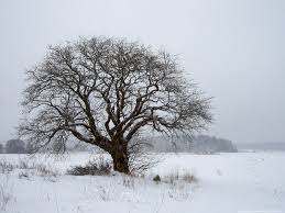
COLD

Extreme cold snaps are hazardous to humans and their livestock. In a 2003 Mongolian cold snap, almost 30,000 livestock animals perished due to excessive snow and cold. When the temperature drops, caloric intake must increase to maintain body heat to for shivering.

  Disease

Disease becomes a disaster when it spreads in a pandemic or epidemic as a massive outbreak of an infectious agent. Disease is historically the most dangerous of all natural disasters. Different epidemics are caused by different diseases, and different epidemics have included the Black Death, smallpox, and AIDS. The Spanish flu of 1918 was the deadliest ever epidemic, it killed 25-40 million people. The Black Death, which occurred in the 14th Century, killed over 20 million people, one third of Europe's population. Plant and animal life may also be affected by disease epidemics and pandemics.

Drought 
Drought
 A drought is a long-lasting weather pattern consisting of dry conditions with very little or no precipitation. during this period, food and water supplies can run low, and other conditions, such as famine, can result. Droughts can last for several years and are particularly damaging in areas in which the residents depend on agriculture for survival. The Dust Bowl is a famous example of a severe drought.
Worst Case:
The Horn of Africa witnessed the worst drought in 60 years in 2011, leaving more than 12.4 million people with limited to no food supply. Due to its impact, a draught has to be included in the list of natural disasters.

  Earthquake 

Earthquake Impact on Expressway


 An earthquake is a sudden shift or movement in the tectonic plate in the Earth's crust. On the surface, this is manifested by a moving and shaking of the ground, and can be massively damaging to poorly built structures. The most powerful earthquakes can destroy even the best built of structures. In addition, they can trigger secondary disasters, such as tsunamis and volcanic eruptions. Earthquakes occur along fault lines, and are unpredictable. They are capable of killing hundreds of thousands of people, such as in the 1976 Tangshan and 2004 Indian Ocean earthquakes.

Worst Case:
In 2008, the 7.9 magnitude earthquake that struck Wenchuan, a county of Sichuan Province in China was devastating and killed over 61,150 people.

  Famine


Famine is a natural disaster characterized by a widespread lack of food in a region, and can be characterized as a lack of agriculture foodstuffs, a lack of livestock, or a general lack of all foodstuffs required for basic nutrition and survival. Famine is almost always caused by pre-existing conditions, such as drought, but its effects may be exacerbated by social factors, such as war. Particularly devastating examples include the Ethiopian famine and the Irish Potato Famine.

  Fire 
FIRE

 A fire is a natural disaster that may destroy ecosystems like grasslands, forests causing great loss of life, property, livestock and wildlife. Bush fires, forest fires and mine fires are generally started by lightning, but also by human negligence or arson, and can burn thousands of square kilometers. An example of a severe forest fire is the Oakland Hills firestorm. A mine fire started in Centralia, Pennsylvania in 1962 decimated the town and continues to burn. Some of the biggest city fires are The Great Chicago Fire, The Great Fire of London, and The San Francisco Fire.
Worst Case:
The Peshtigo Fire in Wisconsin is the deadliest wildfire in U.S. history with estimated deaths of over 2,500 people.

  Flood 
FLOOD

 A flood is a natural disaster caused by too much rain or water in a location, and could be caused by many different sets of conditions. Floods can be caused by prolonged rainfall from a storm, including thunderstorms, rapid melting of large amounts of snow, or rivers which swell from excess precipitation upstream and cause widespread damage to areas downstream, or less frequently the bursting of man-made dams. A river which floods particularly often is the Huang He in China, and a particularly damaging flood was the Great Flood of 1993.

  Hail 
Hail

 A hailstorm is a natural disaster where a thunderstorm produces a numerous amount of hailstones which damage the location in which they fall. Hailstorms can be especially devastating to farm fields, ruining crops and damaging equipment. A particularly damaging hailstorm hit Munich, Germany on August 31, 1986, felling thousands of trees and causing millions of dollars in insurance claims. Skeleton Lake was named so after 300-600 people were killed by a hailstorm.

  Heat 
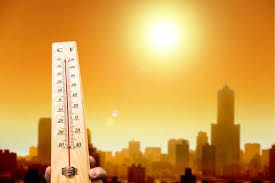
HEAT

 A heat wave is a disaster characterized by heat which is considered extreme and unusual in the area in which it occurs. Heat waves are rare and require specific combinations of weather events to take place, and may include temperature inversions, katabatic winds, or other phenomena. The worst heat wave in recent history was the European Heat Wave of 2003.

  Hurricane 
Hurricane


 A hurricane is a low-pressure cyclonic storm system which forms over the oceans. It is caused by evaporated water which comes off of the ocean and becomes a storm. The Coriolis Effect causes the storms to spin, and a hurricane is declared when this spinning mass of storms attains a wind speed greater than 74mph. In different parts of the world hurricanes are known as cyclones or typhoons. The former occur in the Indian Ocean, while the latter occur in the Eastern Pacific Ocean. The most damaging hurricane in the United States was Hurricane Katrina, which hit the United States Gulf Coast in 2005.
Worst Case:
Bhola cyclone that hit Bangladesh in 1970 is considered the deadliest since it caused the deaths of over 500,000 lives.

  Impact event

Impact event


 Impact events are caused by the collision of large meteoroids, asteroids or comets (generically: bolides) with Earth and may sometimes be followed by mass extinctions of life. The magnitude of the disaster is inversely proportional to its rate of occurrence, because small impactors are much more numerous than large ones.

  Landslide 
LandSlide

 A landslide is a disaster closely related to an avalanche, but instead of occurring with snow, it occurs involving actual elements of the ground, including rocks, trees, parts of houses, and anything else which may happen to be swept up. Landslides can be caused by earthquakes, volcanic eruptions, or general instability in the surrounding land. Mudslides, or mud flows, are a special case of landslides, in which heavy rainfall causes loose soil on steep terrain to collapse and slide downwards - these occur with some regularity in parts of California after periods of heavy rain. Mudslide A mudslide is a slippage of mud because of poor drainage of rainfall through soil. An underlying cause is often deforestation or lack of vegatation. Some mudslides are massive and can decimate large areas. On January 10, 2005 at 1:20pm in La Conchita, a massive mudslide buried four blocks of the town in over 30 feet of earth. Ten people were killed by the slide and 14 were injured. Of the 166 homes in the community, fifteen were destroyed and 16 more were tagged by the county as uninhabitable.

  Sink hole 
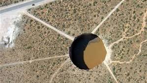
Sink Hole

 A sinkhole is a localized depression in the surface topography, usually caused by the collapse of a subterranean structure, such as a cave. Although rare, large sinkholes that develop suddenly in populated areas can lead to the collapse of buildings and other structures.

  Solar flare


 A solar flare is a violent explosion in the Sun's atmosphere with an energy equivalent to tens of millions of hydrogen bombs. Solar flares take place in the solar corona and chromosphere, heating the gas to tens of millions of kelvins and accelerating electrons, protons and heavier ions to near the speed of light. They produce electromagnetic radiation across the spectrum at all wavelengths from long-wave radio signals to the shortest wavelength gamma rays. Solar flare emmissions are a danger to orbitting satellites, manned space missions, communications systems, and power grid systems.

  Storm surge
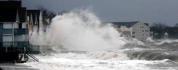
Storm surge


 A storm surge is an onshore rush of water associated with a low pressure weather system, typically a tropical cyclone. Storm surge is caused primarily by high winds pushing on the ocean's surface. The wind causes the water to pile up higher than the ordinary sea level. Storm surges are particularly damaging when they occur at the time of a high tide, combining the effects of the surge and the tide. The highest storm surge ever recorded was produced by the 1899 Bathurst Bay Hurricane, which caused a 13 m (43 feet) storm surge at Bathurst Bay, Australia. In the US, the greatest recorded storm surge was generated by Hurricane Camille, which produced a storm surge in excess of 25 feet (7.6 m).

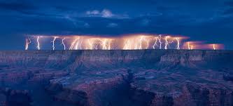
  Thunderstorm 
Thunderstorm

 A thunderstorm is a form of severe weather characterized by the presence of lightning and its attendant thunder, often accompanied by copious rainfall, hail and on occasion snowfall and tornadoes. Tornado A tornado is a natural disaster resulting from a thunderstorm. Tornadoes are violent currents of wind which can blow at up to 318mph. Tornadoes can occur one at a time, or can occur in large tornado outbreaks along a squall line. The worst tornado ever recorded in terms of wind speed was the tornado which swept through Moore, Oklahoma on May 3, 1999. This tornado had wind speeds of 318mph and was the strongest ever recorded.

  Tsunami 
TSUNAMI


 A tsunami is a giant wave of water which rolls into the shore of an area with a height of over 15 m (50 ft). It comes from Japanese words meaning harbor and wave. Tsunamis can be caused by undersea earthquakes as in the 2004 Indian Ocean Earthquake, or by landslides such as the one which occurred at Lituya Bay, Alaska. The tsunami generated by the 2004 Indian Ocean Earthquake currently ranks as the deadliest tsunami in recorded history.
Worst Case:
The 2004 Indian Ocean Tsunami is the deadliest of all time causing about 280,000 deaths.

  Volcanic eruption 
Volcanic eruption


 This natural disaster is caused by the eruption of a volcano, and eruptions come in many forms. They range from daily small eruptions which occur in places; like Kilauea, in Hawaii, or extremely infrequent supervolcano eruptions in places like Lake Toba. Recent large volcanic eruptions include that of Mount St. Helens and Krakatoa, occurring in 1980 and 1883, respectively.
Worst Case:
Indonesia witnessed the deadliest volcanic eruption in 1815 when Mount Tambora erupted and killed over 92,000 people.

  Winter storm
Winter Storm

 A snowstorm is a winter storm in which the primary form of precipitation is snow. When such a storm is accompanied by winds above 32 mph that severely reduce visibility, it becomes a blizzard. Hazards from snowstorms and blizzards include traffic-related accidents, hypothermia for those unable to find shelter, as well as major disruptions to transportation and fuel and power distribution systems.

source link:www.armageddononline.org